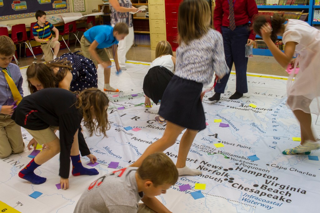
Fuqua gets giant map
Published 4:11 pm Monday, September 19, 2016

- CARSON REEHER | herald Fuqua teacher Kathy Jefferson explains with Noah Cole how to measure distances on the large map using a chain with links.
For two weeks, Fuqua School students are engaging with state geography in new ways, using a large map of Virginia borrowed from the Virginia Geographic Alliance (VGA). Kathy Jefferson, a fourth and fifth grade teacher, received training in July on how to use the map for classroom instruction. During the past week, Jefferson has used the map to teach elementary students at Fuqua.
According to VGA State Coordinator and Longwood University professor Dr. Ed Kinman, the map is about 20-feet by 28-feet large and gifted to VGA by the National Geographic Society. The gift marks the 30th anniversary of the state alliances. VGA also has plans to purchase more of the large state maps to lend out to schools across the state, Kinman said.
For a fee, schools can also rent larger maps of continents and oceans from the society.
Trending
Jefferson said the giant traveling maps give children a sense of place and location. Lessons provided with the maps allow teachers to integrate games into the learning process, making the lessons fun and engaging, she said.
“All of the students have been very excited to have a map that they can walk on and relate to. It has been a wonderful resource to introduce or to follow-up social studies lessons,” Jefferson said.
With Pre-K students, Jefferson taught her students to identify water, land and mountains. They also searched for letters in their names. With kindergarten and first graders, they learned cardinal directions by playing “Simon Says.” Jefferson said fourth- and fifth-grade students located map features, cities and bordering states by playing a regional scavenger hunt. They also learned measurement and scale during math class.
Jefferson is working on additional lessons specific to Virginia which encompass social studies, science and math concepts.
“These include the five regions of Virginia; Virginia waterways and watersheds; significant battle locations; and Virginia resources, animals, and plants,” she said.
Kinman said it’s a way for students to bring understanding to Virginia studies and to make connections.
Trending
“There is a lot of research that has gone into creating these and understanding why they work,” he said, adding everyone needs to have a basic spatial skill set including an understanding of distance and directions.
The map activities allow students to have a more tactile and fun experience with learn those skills.
“I usually notice that the adults find this just as engaging as the little kids,” Kinman said.
The map’s next location will be in Kinman’s “Thinking Geographically” class at Longwood University. Jefferson will be a guest teacher, helping Kinman teach future teachers different teaching methods with maps.
Following the lesson, his students will work to come up with lesson plans to go along with the map.
“Hopefully we’ll have some that come out well and we’ll make those available to other people. That’s what the geographic alliance is all about … teachers at all different levels partner with each other to come up with all different ways to teach geo-literacy and spatial thinking,” Kinman said.


