Cleanup continues, with another winter storm system on the way
Published 7:21 am Monday, February 17, 2025
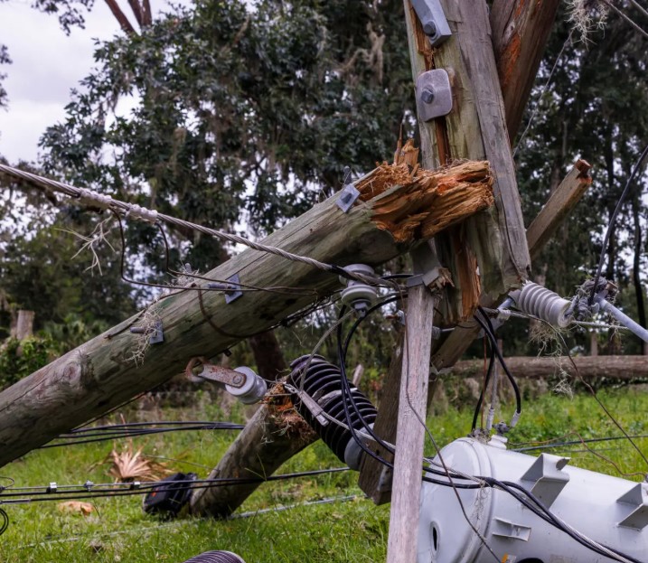
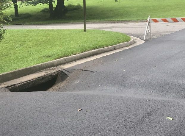
- A look at some of the damage caused by high winds Sunday across the region. Herald photo.
|
Getting your Trinity Audio player ready...
|
As of 6 a.m. Monday, 7.5% of Buckingham customers, 6.5% of those in Cumberland and 1.7% in Prince Edward were still in the dark. High winds the day before, with gusts reaching up to 50 mph, caused power poles in some areas to crack and shut off energy that in some cases, had just been restored after last week’s winter storm. Now as crews from Dominion Energy and Central Virginia Electric Cooperative (CVEC) work to get the lights back on, everyone is also paying close attention to another storm system that is heading this way.
Part of the problem as to why power hasn’t been fully restored to everyone yet involves where the downed lines and poles are. According to Dominion officials, a lot of the work, both Sunday and overall this past week, has required a multi-tiered plan.
“We had three poles down at one work site,” said Dominion spokesman Craig Carper. “It required forestry crews to go in first to remove tree damage, before they could get a second crew, a lineman crew, to go in and work on the line. There’s a fair amount of that.”
Trending
The biggest issue, Carper said, has been access, with some of the damage happening in densely wooded places that vehicles can’t go. So first, workers have to go out and do a visual inspection, to figure out what happened and what needs to be fixed. Then, they have to determine what type of crews are needed to tackle one site and get that on the schedule, as teams work around the clock on cleanup. Some of these sites have been a four to five hour repair job, Carper said, with poles cracking or falling over due to the high winds that arrived Sunday.
Turning towards another winter storm
The goal, according to both Dominion and CVEC officials, was to get everything repaired Monday, as all eyes turn toward a system expected to arrive in this area about the middle of the week.
According to officials from the National Weather Service (NWS) station out of Wakefield, it’s too early to estimate snowfall totals. And, they acknowledge, there’s a good deal we still don’t know about what this system will or won’t do.
What we do know, NWS officials told The Herald early Monday, is that cold air will be in place, with most of the region remaining below freezing Wednesday when the weather system arrives. That means most likely snow starts falling Wednesday and continues through Wednesday night, before ending on Thursday.
Now here’s what could change. If the storm takes a northern track, that means the heavy snow will fall north of here, with more mixed precipitation (sleet, freezing rain) showing up in Farmville and the surrounding areas. If the system takes a southern track, then that means heavier snow could set up over Farmville and Prince Edward overall, along with Charlotte and possibly Lunenburg counties. NWS officials said they weren’t ready yet to put estimates out. Instead, it’s just time to warn people about what could be coming.
“For now, know that this storm has a high ceiling and the potential is there for a significant winter storm,” NWS officials said in a statement posted to social media.